 |
Winter Riding Range: Pinenut Mtns.
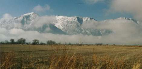
- Location: The Pinenut Mountains are located east of Lake
Tahoe, across the Carson Valley.
- How to get there: Two major access points on the west side
of the Pinenuts are at Johnson Lane/Sunrise Pass Road, to the
north, and Pinenut Road to the south.
- From Lake Tahoe, drive east over Kingsbury Grade and drop
down to the Carson Valley. Continue straight on Mottsville Lane
to the first intersection. This is Highway 88. Turn left, north,
until you reach the junctions with Highway 395.
- Turn right, east. Go through Minden and Gardnerville. At the
far end of town, there is a light at the corner of Pinenut Road;
turn left. Follow Pinenut Road out to the Douglas County Fair
Grounds. Park here and ride the following trails.
- Or, keep going north on 395 to Johnson Lane. To access Sunrise
Pass Road, turn east onto Johnson Lane from Highway 395 half way
between Minden and Carson City, Nevada. Go to the end of the pavement.
You can park here and ride.
- Trail Difficulty: From very easy to fairly difficult.
- BLM Map: Reno and Smith Valley
- Elevation Range: 5,000 - 9,300+ feet elevation
- Trail Photos: Coming soon
- Trail Descriptions: Follows on this
page
- Trail Length: Varies. Ride as far as you feel like!
- Camping: Free camping all through BLM land, however, much
private land is interspersed. Heed the no trespassing signs.
- Water and grazing availability: Grazing and water at 'Sheep
Camp', and various other small meadows and creeklets up higher.
- Trail High Points/Low Points: High: Miles of trails forever.
Low: Getting lost or turned around in the vast trail system. Very Low: Shooting!
Trail Description:
The Pinenut Mountains are a wonderfully diverse range. One can follow
sand washes for miles, access old mining roads, follow powerline trails,
or simply cut off cross country. I explore many miles every winter this
way. Just pick a direction and go! (GSP is handy, here.) Most of the
time you can see the Carson Valley or the Sierra, so it's hard to get
really lost. But there are a myriad of trails and new ones are popping up every
season! I'll outline the major roads and well-used trails. Many of these
aren't on the BLM map. Take your copy of the Reno, Carson, and Smith
Valley BLM maps and take the time to mark down roads and trails that
don't appear on these maps.
Every kind of recreation abounds in the Pinenuts. You see people
in jeeps, on motorcycles, on bicycles, quad-runners, station wagons;
people camping, hunting, running, cutting firewood, or gathering pine
nuts in the fall. They don't call these the Pinenut Mountains
for nuttin! Even though Pine Nut trees abound, you'll also see isolated
groves of Aspen tucked away in the folds and drainages up higher.
Sheep Camp from Pinenut Road
A favorite loop is one that starts at 'Sheep Camp'. This spot is
about 4 miles up Pinenut Road. Cross the little creek and continue
up the road, a mile or so until you come to a curve with a junction
of another road coming down the canyon and ending in a mud puddle.
Watch out for this puddle...if your horse is thirsty, as it has been
known to swallow a motorcycle and a small pony. Veer right, down canyon
for 50 yards, then continue up the next canyon, Blossom Canyon. Keep
to the right until you plateau high up. The terrain opens up as you
climb. Near the top of a saddle, you need to keep a sharp eye out
for a very rocky trail that barely shows the immense traffic it gets.
Turn right up the trail and follow it up, then all the way back down
to Sheep Camp for a complete loop.
Hot Springs Mountain from Johnson Lane
Anywhere you park at the end of Johnson Lane will give you unlimited
riding opportunities. I generally head north, east, or south, ride
as long as I care to, then wind my way back!
If a more specific destination is more to your liking, try heading
to Hot Springs Mounain. This "hill" is north from Johnson
Lane, the obvious hill blocking your view if you were to try to see
Carson City from here. Jump on one of the many trails heading north.
The ones in the valley are very sandy and make for a nice lope through
the sage, or you could head directly to the Power Line. It starts
off rocky and has some steep ups and downs until it, too, flattens
out on the east side of this nice sage valley and heads all the way
to Mexican Dam.
To ride up to the top of Hot Springs Mountain, I like to ride to
the north side, up a nice sandy jeep trail, that looks like it splits
the mountain in two. It ends up looping around near the top, then
goes down the south side, back towards the houses off Johnson Lane.
The south-facing slope of Hot Springs Mountian is fairly steep at
the top, but the view of the Carson Valley with the surrounding PineNut
and Sierra Mountains is wonderful!
|
 |